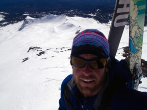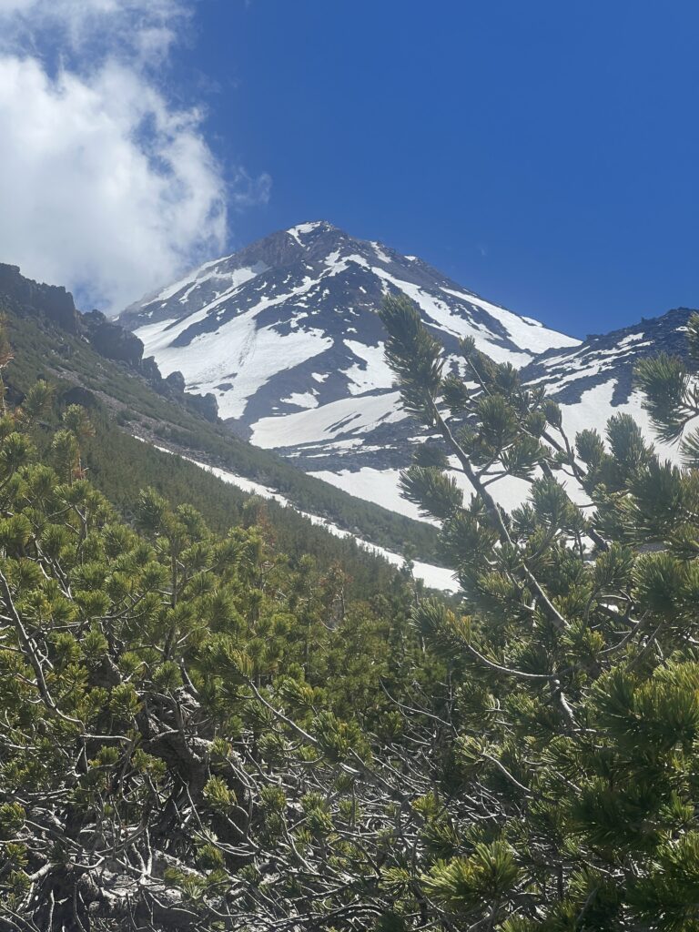
June 29, 2024: First views of the Hotlum Bolam Ridge from near 8,000 feet on the Northgate trail on a guided climb of Mt Shasta. The trail is a shaded hike through old growth stands of Shasta Red Fir, a conifer species that’s endemic to the northern California area. As you near tree line, you’ll encounter some small stands of krummholz White Bark Pine which have had a hard life battling strong alpine winds and an evasive beetle infestation.
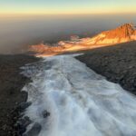
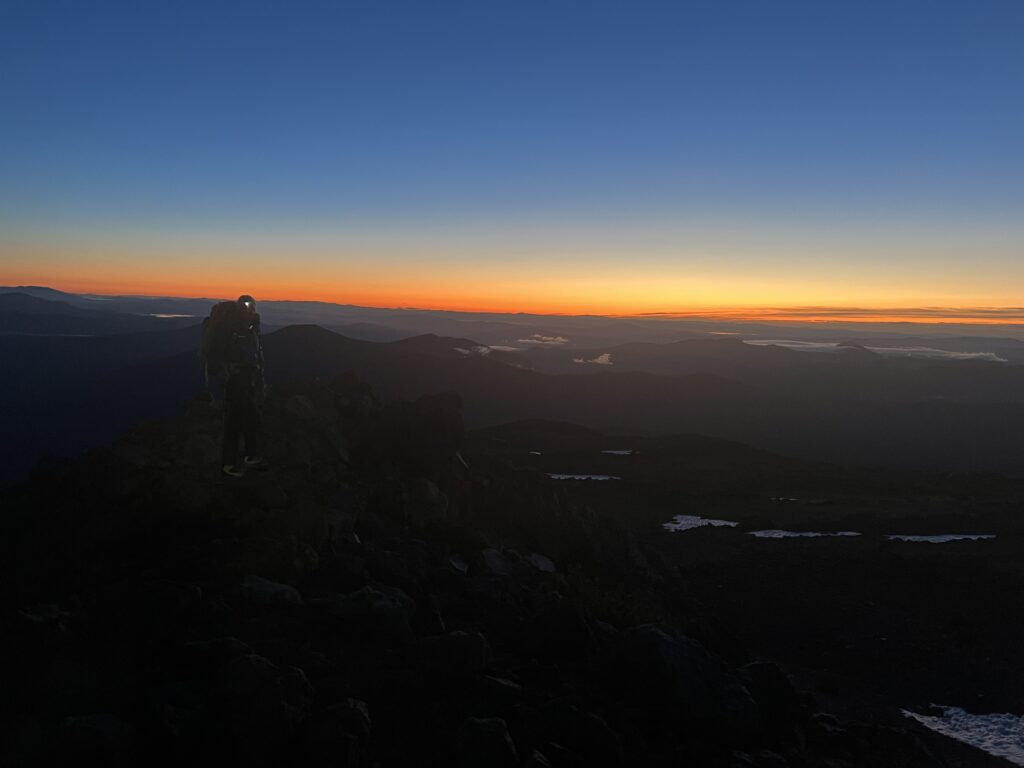
From June 29 through July 1, our first trip of the year set out on a guided climb of the Hotlum Bolam Ridge on Mt Shasta’s northern flanks with Shasta Mountaineering School. The Hotlum Bolam ridge route is one of my favorite routes to guide on Mt Shasta due to the remote wilderness experience and the steeper climbing that tops out directly on the northern end of the summit cone. We established a low base camp at 9,100 feet and were rewarded with a beautiful alpine sunset. As the sun set, brilliant orange and red hues filtered between the Klamath Mountains on the horizon and a lowering inland marine layer.
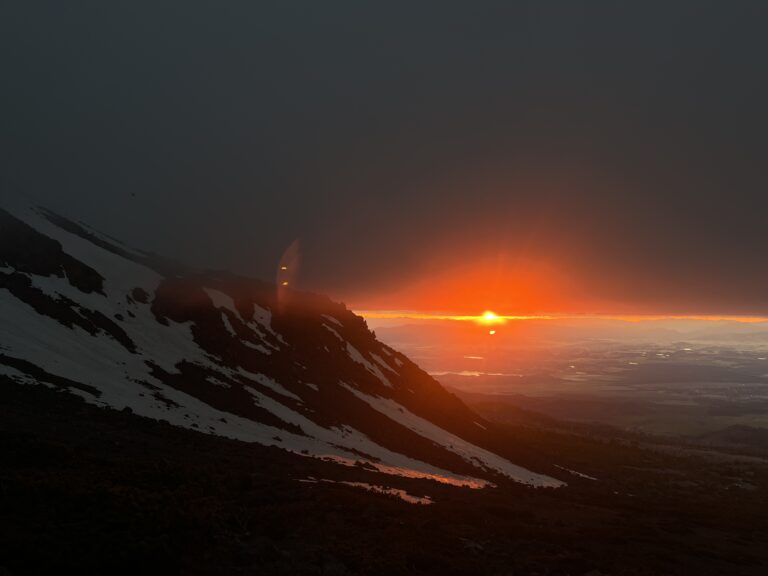
June 29, 2024: The setting sun from our base camp at 9,100 feet below the Hotlum Bolam Ridge on a guided climb of Mt Shasta.
We found the Hotlum Bolam Ridge route in great condition on our guided climb of Mt Shasta. On the second day of our trip, we left camp at 4:30am and gained the lateral moraine above camp at approximately 10,000 feet. This moraine extends along the northeastern flank of the Hotlum Glacier. Once on top of the moraine, we followed the well-worn path along the top of the rocky ridge to an elevation of 11,800 feet. This is most common way to climb the lower part of the route.
From the top of the lateral moraine below the rock headwall, we donned crampons and a rope. We set out on snow for the first time this trip. We traversed east towards the first steep snow slope, commonly known as The Ramp.
We moved as quickly as possible on the traverse to limit our exposure to the steep rock headwall on the broad ridge from above. On the traverse, we traveled over large sun cups and the remnants of a large rock fall event that occurred on June 5, 2024. This rock fall event subsequently triggered a full-depth large loose-wet avalanche. There are massive basalt boulders scattered on top of the lower snow slopes below offering more evidence to the size of the event. In starting zone, the old avalanche has stripped away the full depth of the seasonal snowpack back to old and dense alpine ice. Traversing through this section requires good footwork for a brief moment in order to maintain positive security. Despite not observing any active natural rock fall throughout the duration of our climb or during our descent, I would approach this area with caution and limit your time beneath the unstable rock.
June 30, 2024: Sunrise at approximately 10,000 feet shortly after gaining the lower portion of the lateral moraine that leads to The Ramp on the Hotlum Bolam Ridge on Mt Shasta.
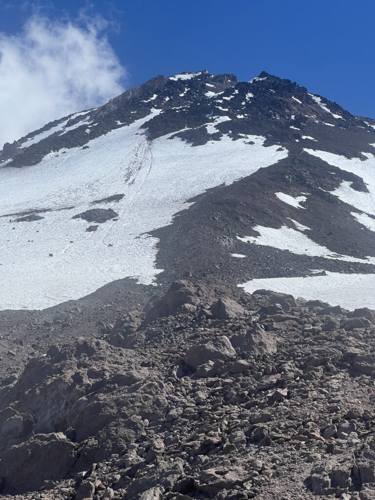
June 30, 2024: Standing on the lateral moraine, looking up at the Hotlum Bolam Ridge on Mt Shasta. The Ramp is visible (top, center, left) as well as the remnants of the large rock fall event at the base of The Ramp that occurred on June 5, 2024. The rock fall event was witnessed and a full write up about the event can be found on the Mt Shasta Avalanche and Climbing Information Center website by going here.
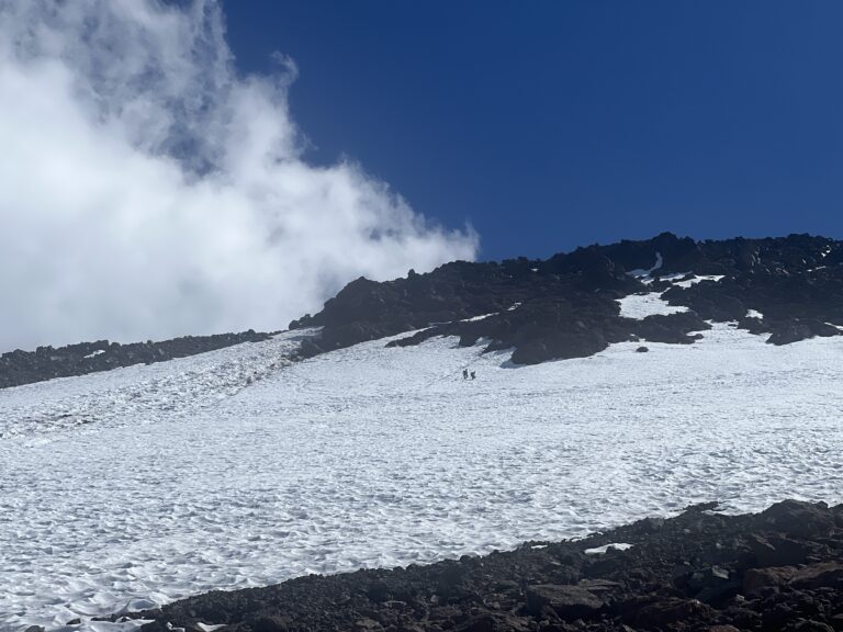
June 30, 2024: On our descent, I took this photo of two climbers also on descent making the traverse from The Ramp back to the right towards the top of the lateral moraine at approximately 11,800 feet. The rock fall debris/avalanche debris and large sun cups are clearly visible in this photo and make the travel more tedious.
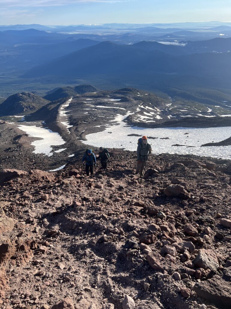
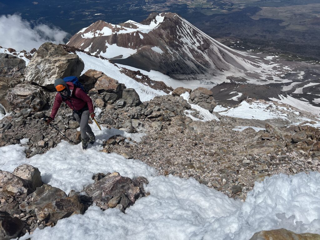
June 30, 2024: From approximately 11,500 feet, looking north down the route. In the background, the town of Klamath Falls, Oregon is in the valley beneath the cloud layer. In the foreground, you can see the obvious moraine/ridge that leads you from base camp to The Ramp. The drainage on the left with the large snow field is the summer approach path. In this drainage, there are a a number of rock ringed camps which are established between 9,000 and 10,000 feet at various elevations. This is the best place to camp to find a water source year around. If you are climbing in the Fall, camp lower to find water. The lateral moraine/ridge proper also has a number of a good bivy sites along the well-establish path. However, sourcing water from the ridge will prove to be more difficult later in the season.
The Ramp itself hosted good frozen snow in morning hours, but like much of the mountain this year, the snow surface is variable and larger than normal sun cups are present. Snow coverage on The Ramp extends all the way to the flat area above near 13,000 feet. This flat area is known as The Step. We climbed our way up The Ramp using long switchbacks to make for efficient cramponing. As you near The Step, there is often more shallow seasonal snow accumulation and it is important that if rocks are present that you don’t accidentally kick these rocks loose. Human triggered rock fall will continue to roll down the Ramp and the snow slopes below. This creates a hazard for climbers beneath you.
Once arriving at The Step, we took a break. The Step is an excellent large flat area where you can take a minute for a drink of water and a bite to eat. We also took a short walk to have a look at the top of the Hotlum Glacier. The upper bergshrund on the Holtum Glacier is well open. Mt Shasta’s Hotlum Glacier is the largest and most voluminous glacier in California. The glacier offers nice picturesque views of blue glacial ice. On the steeper slopes above The Step, currently, there is snow coverage for a couple hundred vertical feet. We travelled on these snow slopes before we were forced to travel on rock up for the final 100 vertical feet to the basalt gendarmes known as the Rabbit Ears.
From The Rabbit Ears proper, we began the traverse west. The traverse follows a well-defined path that contours west towards the Shark’s Fin. Above the Shark’s Fin, we climbed up and removed the rope as the slope angle lessens. We travelled straight up on lower angle slopes of intermittent snow and loose rock to the north summit. The north summit shares the same conical feature as the true summit. From the north summit, it is a well-defined mostly flat walk along the top of the summit ridge to the true summit.
To descend the Hotlum-Bolam Ridge, retrace your ascent path and take the same route. Be aware that you’re now descending later in the day and with that there is now increased rock fall hazard during the hottest time of the day.
If you’re interested in climbing Mount Shasta via the Hotlum Bolam Ridge with Shane from Shasta Mountaineering School as your guide, check out our guided summit trips page.
- Make sure you continue on rock all the way to the Rabbit Ears proper to find the correct traverse path. Don’t traverse to too low.
- The traverse path leads west from the Rabbit Ears, across the Bolam Gully, to the Shark’s Fin. The Shark’s Fin is another prominent basalt rock feature. This is the best way to go in the summer and late season once the seasonal snow melt has began.
- In the winter or early spring before the seasonal snow melt has began, it is possible to climb on snow over loose rock above the Rabbit Ears directly to the summit. This route variation is advised against once the snow has melted.
- Late in the season, the Bolam Gully and the gully to the left of the Rabbit Ears (Hotlum Headwall – Right Gully) can host very hard alpine ice. Steel crampons on at least three quarter shank mountaineering boots should be mandatory for this route any time of the year. For icy conditions, you may also want to consider a bringing a couple of ice screws and a second ice tool as well.
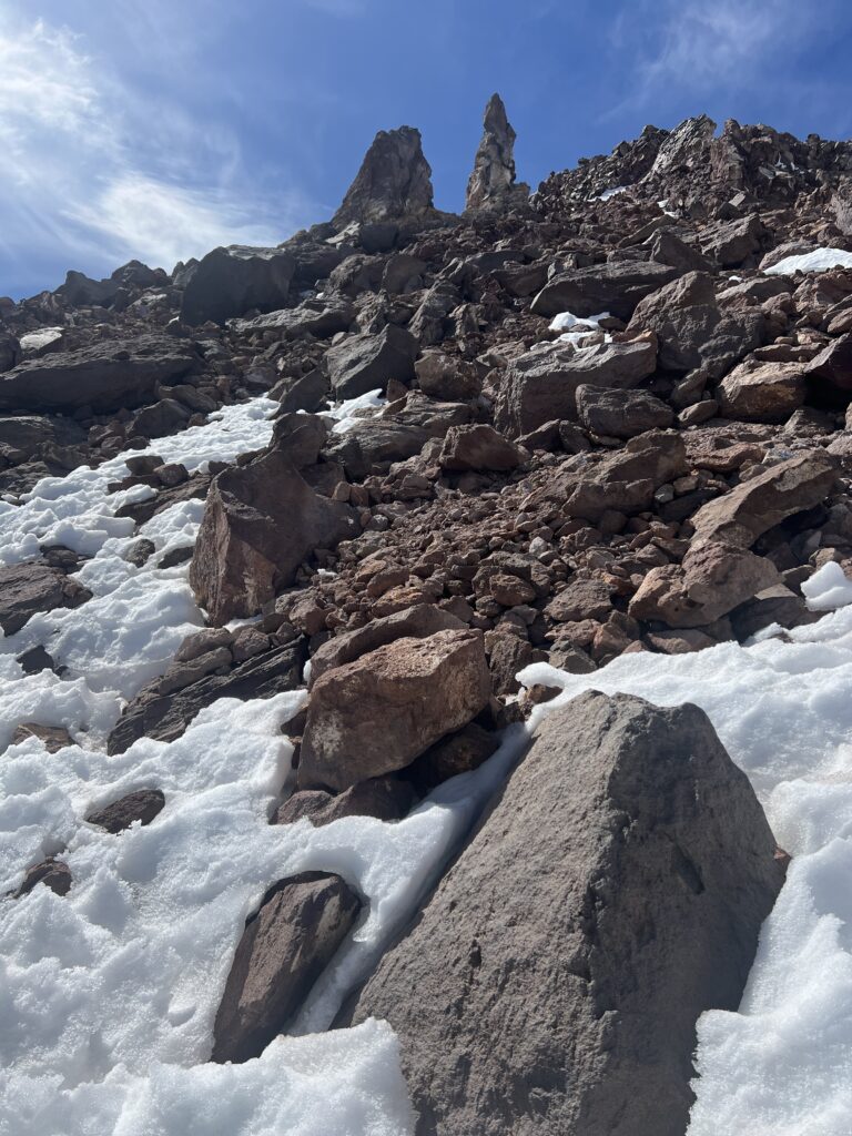
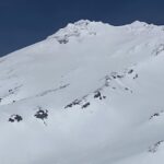
July 1, 2024: This photo is taken looking up at the Hotlum Bolam Ridge route on Mt Shasta at approximately 13,500 feet just below the Rabbit Ears. This is where the snow slopes finish and we were forced to travel on rock up to the Rabbit Ears. Make sure you continue all the way up to the Rabbit Ears proper to find the correct traverse path to the west. Once reaching the path, which begins at the highest of the two Rabbit Ears, travel to the west all the way to the Shark’s Fin. A common mistake is to make the traverse too low.
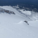
July 1, 2024: This photo is taken at approximately 14,000 feet on Mt Shasta and is looking down on the northern slopes of the summit cone. Mt Shasta’s summit sits at 14,179 feet. Mt Shastina is visible in the background.
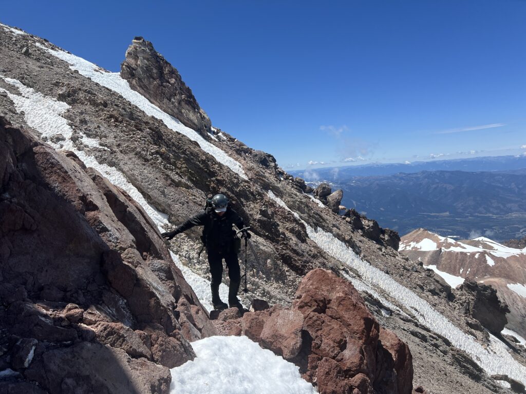
July 1, 2024: On our descent from Mt Shasta’s summit, looking west towards the traverse towards Bolam Gully and the Shark’s Fin. The Shark’s Fin is visible in the background.